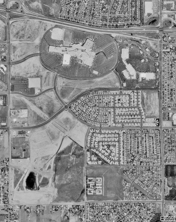
| The Highway 60 freeway is at the top
(north) of the photo.
The malls have obliterated the old Turn
6 and Turn 8 areas. I see no sign of the "esses"
in this photo.
Day St. runs north to south along the
left (west) side. Frederick St. is on the right (east).
Eucalyptus St. now extends across the
grounds as "Towngate St.".
Cottonwood St. marks the south boundary
of the old raceway site.
The "catchment basin" is immediately
north of Cottonwood St. and abuts Day St. on the west.
The remnants of Turn 9 are visible going
into and out of the "basin". |